Thresholds Issue ❷ ↓ Insights
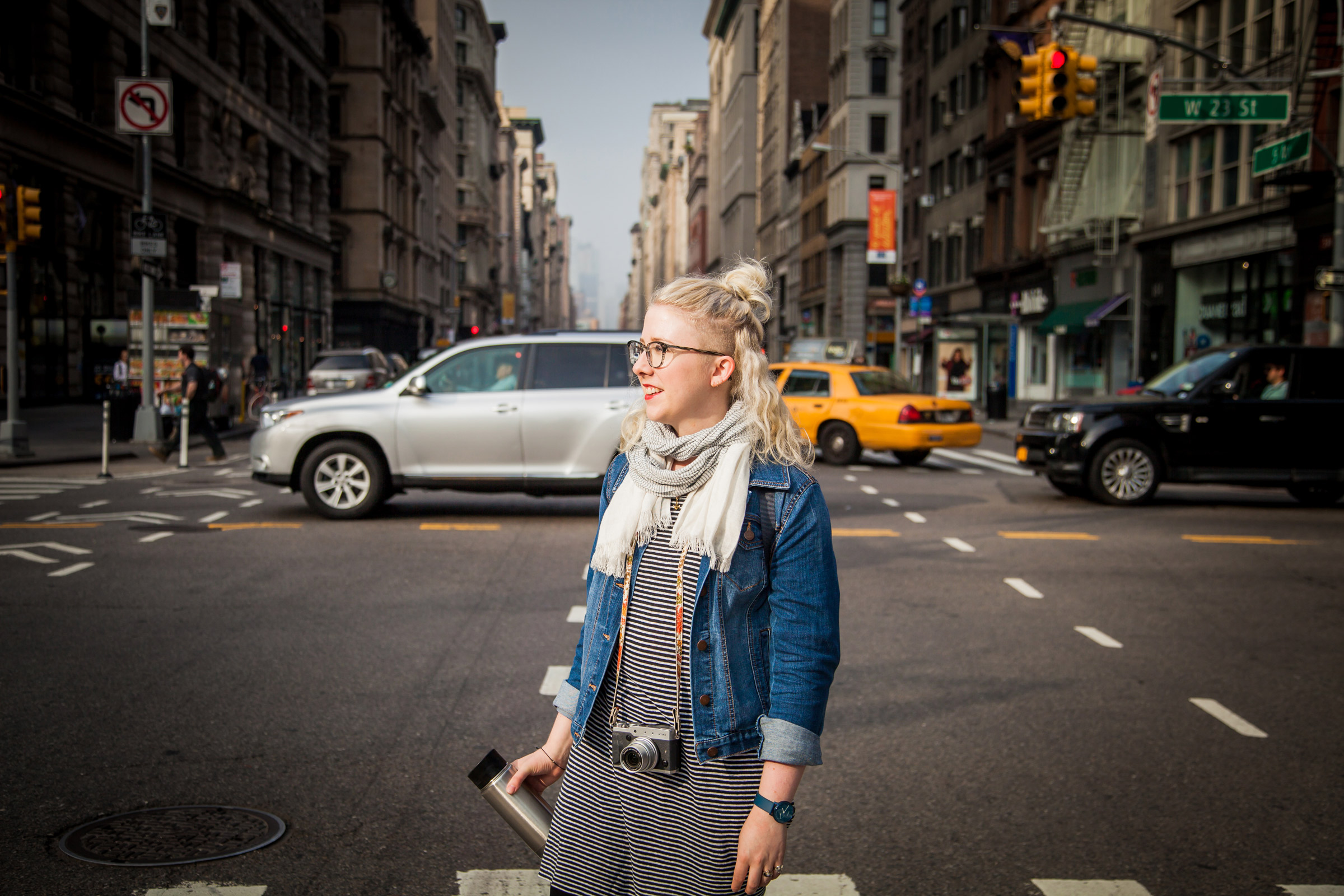
Think about planning a trip to a foreign city. Maybe it’s to a city in your home country or a far-off land where you don’t speak the language. You book your hotel and look up things to do before setting off on your journey. However, upon landing at the airport, you realize that signs are difficult to understand and finding the local transportation is challenging. When you finally decide to take a taxi, you arrive at the hotel in need of a place for dinner. The local buses are confusing, so you decide to walk in the direction that you think seems right. With no maps of the area, you rely on road signs, designed for drivers, and your mapping app (where there is wifi). You know you need to meet your friend at a park, but with no map of the public space you don’t know where to find the landmark she spoke of. Delayed, lost, frustrated, and confused, you find that your experience of the unfamiliar city is tainted by a lack of mental familiarity.
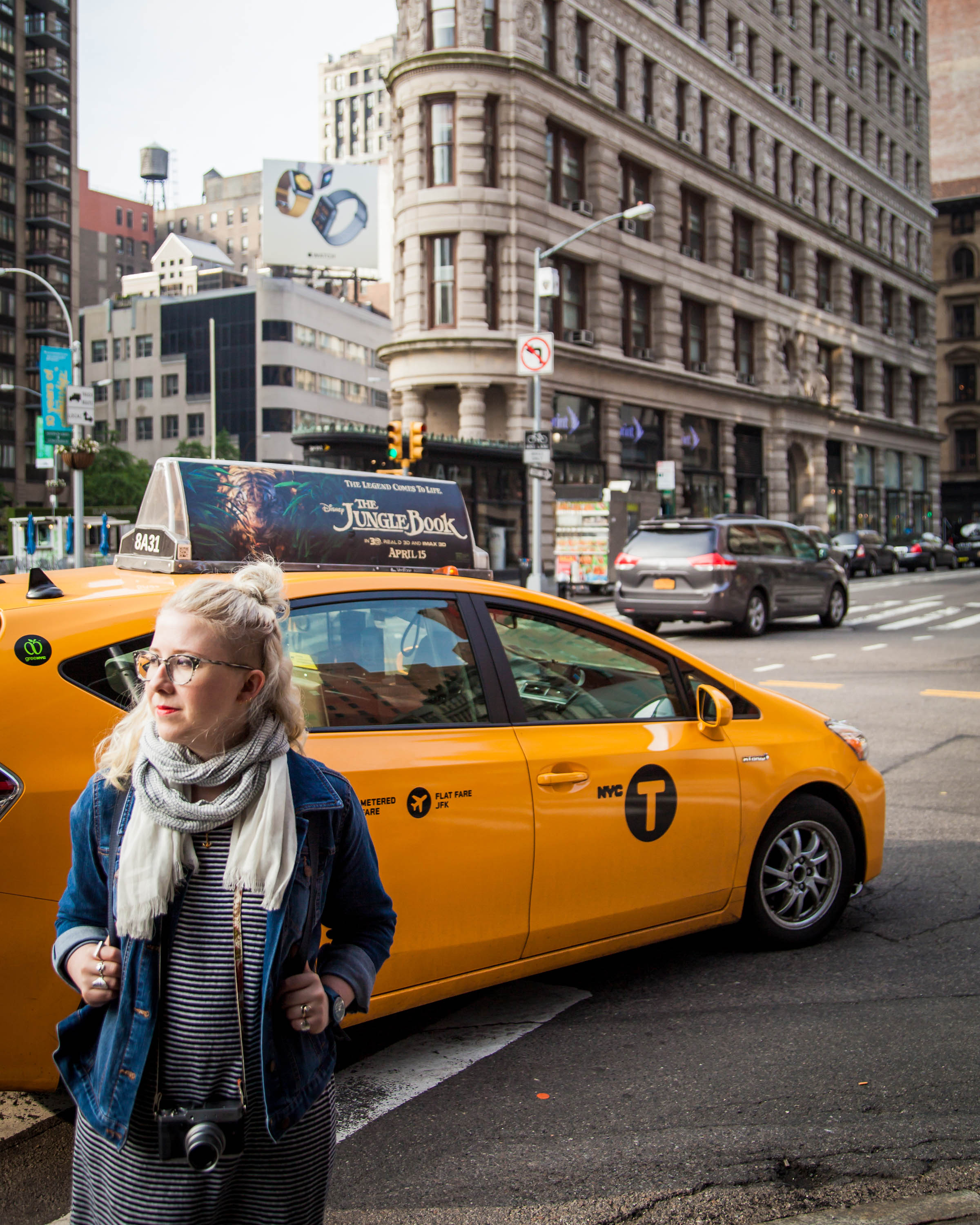
For the confident explorer, the above might not seem like much of a challenge. But what if you are a beginner, or a mom or dad with kids, or someone trying to navigate via wheelchair? Think about the day-to-day experience of people moving around the globe or simply wandering around in their own city. Think about a tourist, but also think about a newcomer or a local.
Cities are environments unlike any other in our world—ecosystems of places and parts that we humans create for ourselves to live in. Rather than finding our biological fit within a savannah or tropical rainforest as we did in the past, we now create our own concrete jungles and suburban savannahs where we find shelter and food and struggle to stay alive amongst the bustle of human cohabitation.
Wayfinding—or using literal and subliminal indicators in the built environment to aid in navigation—caters to the most basic, and I would argue best, of the human condition: people getting around on their own two feet. Walking has been shown to improve moods, it’s good for your health, and it’s the most sustainable form of transportation. Also, just as we’re seeing a return to dense, walkable urban centers like the cities of old (and the active transportation that goes with them), we’re seeing a surge in need for wayfinding systems that enhance and inform those journeys.
The Wonderful World of Wayfinding
In the world of wayfinding, Kevin Lynch is king. An urban planner practicing in the 1960s, Lynch created a system of analyzing people’s internal navigation systems in space. Through studying several North American cities and people’s mental maps of the built form, he discovered five key elements that were constant in our perception of urban space: nodes, edges, landmarks, paths, and districts. In wayfinding work today, researchers and designers continue to use these tools when working out the best places to put information products—the signs and signifiers of wayfinding—or what needs to be shown at a particular location. Putting ourselves in the pedestrian’s shoes is absolutely necessary to deliver what is called the “whole journey” concept: the right information, at the right time, in the right format.
In today’s 21st-century world of smartphones and mapping platforms, you would be excused for wondering why physical maps of city streets are even necessary anymore. What I love about wayfinding is that it’s so much more than just maps. It’s really about the democratic use of public space and adding to a larger concept known as “complete streets.”
Along with such complete street improvements as dedicated lanes for active transportation (buses, bikes), street trees, wider sidewalks, benches, cafe seating, and shortened (and safer) crosswalks, wayfinding fits nicely in the streetscape to encourage and aid you in exploring your city by foot. More than this, wayfinding is also a part of the subtle cues in the built environment. An overflowing trashcan, chalk on the sidewalk, burnt out street lamps, and “no loitering” signs—all of these have a near-subconscious impact on our reading of space. The many signs, advertisements, and even subliminal signals like those listed above make for a confusing urban soup of information to process. Having wayfinding present acts as a beacon and often eliminates clutter in the landscape by consolidating information, making it easier to navigate the city. Even if you’re relatively sure of your direction, double-checking the route on the nearest wayfinding sign is reassuring and gives you the confidence you need to keep on walking.
This kind of information in public space is also democratic space in action. Your ability to impact or influence the environment around you is a part of your right to the city—but so is your access to information. With wayfinding, the information is given to you by a variety of products, at no charge, for whatever destination you may have. Every part of your journey gives you the information you need at that time—from planning your trip in your house to making that transfer connection at a bus stop. This information can include anything from a website and app to a print map or signpost on the street.
With the rise of “smart city” thinking, it’s tempting to leap to the technological conclusion and focus on apps, or even digital kiosks, for wayfinding information. The “wow” factor is there to be sure, but we need to think of every type of user. What about the person who doesn’t own a smartphone, for instance? Or the tourist who doesn’t have wifi? Planning for everyone means true equity in the city—every level of ability, time of day, technical difficulty, and potential destination. More often than not, a good-quality paper map and wayfinding totem is enough for anyone to navigate the city.
Making Cities Legible
Many of these principles were put into practice for the first time nearly twenty years ago when my team carried out the first wayfinding project in Bristol, England. We called the comprehensive way- finding approach “Legible Bristol,” which implied that it was much more than just signs; rather, it was a way to understand the city. To make Bristol “legible,” many urban improvement projects were carried out in succession, not the least of which was the entire redevelopment of an obsolete harbor and the rerouting of a highway that ran through a park. To complement these changes in the environment and get people out and about, we laced a series of durable, illuminated wayfinding signs through the city at major destinations and pathways. Today, these totems are still standing strong, and Bristol takes pride in its reputation as a livable city. This year, we’re beginning work on what will be an updated suite of wayfinding products and platforms for Bristol, sure to last another twenty years.
My role in this process comes before the design is even considered. We have a saying around here—“Design is the easy part”—which shows just how much work is done before the design phase even starts. We begin by gathering as much information about the city or spaces as possible through online research, literature reviews, and direct observations. Like analogue maps and signs, sometimes the most basic of research method is the most effective. Simply by being in the space and critically looking for existing signs and user behavior and reviewing the built environment, we can quickly get a feel for the space. Asking quick questions of passersby—what we call intercept surveys or informational interviews—can supplement our own direct observations. Further along in the project, testing the products in the space and interviewing users before and after installation allows us to make tweaks and inform future projects.
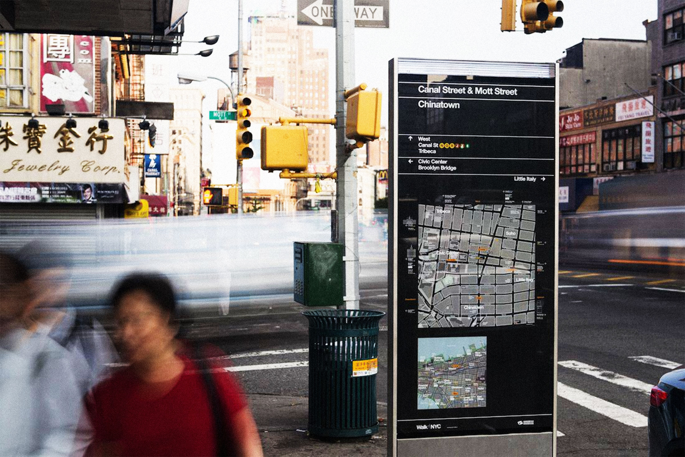
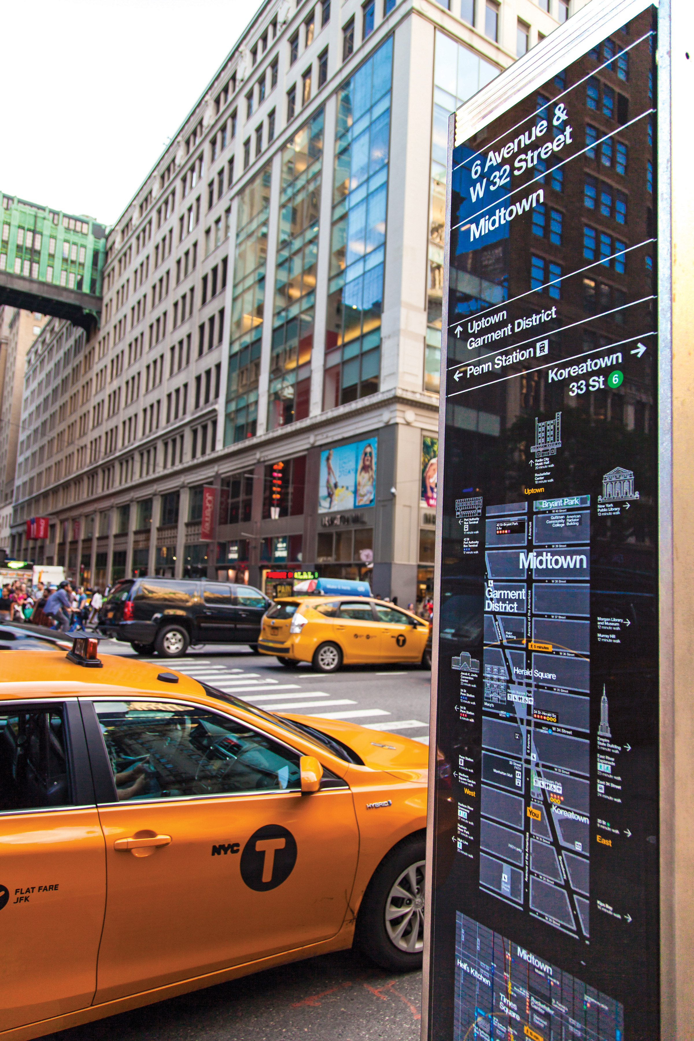
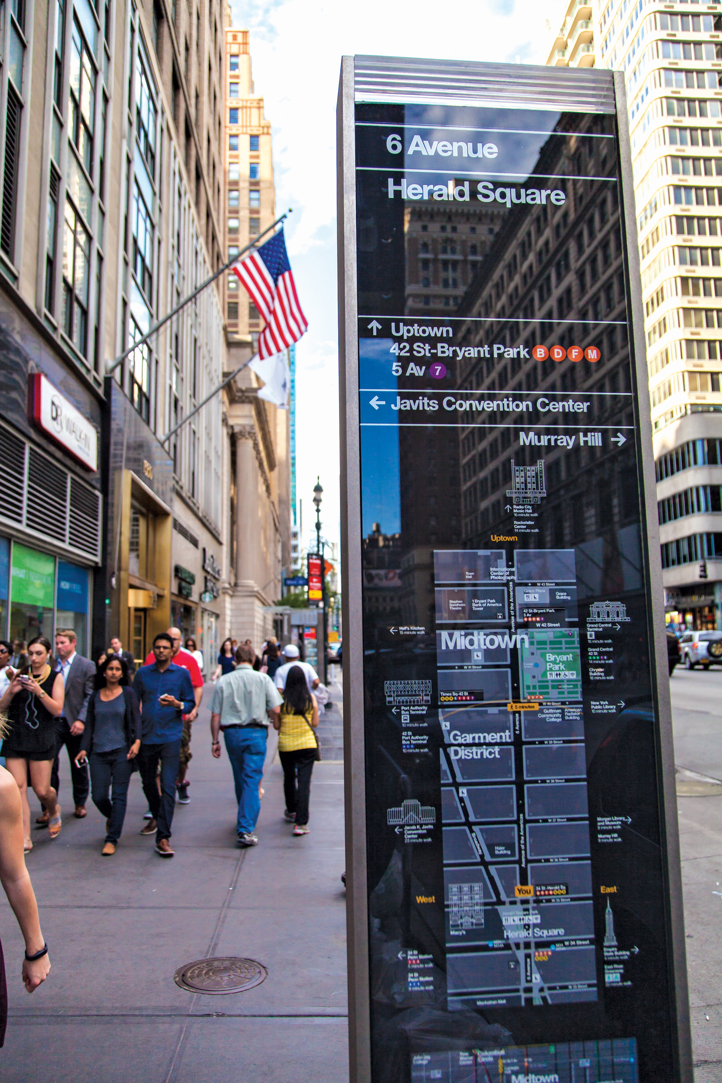
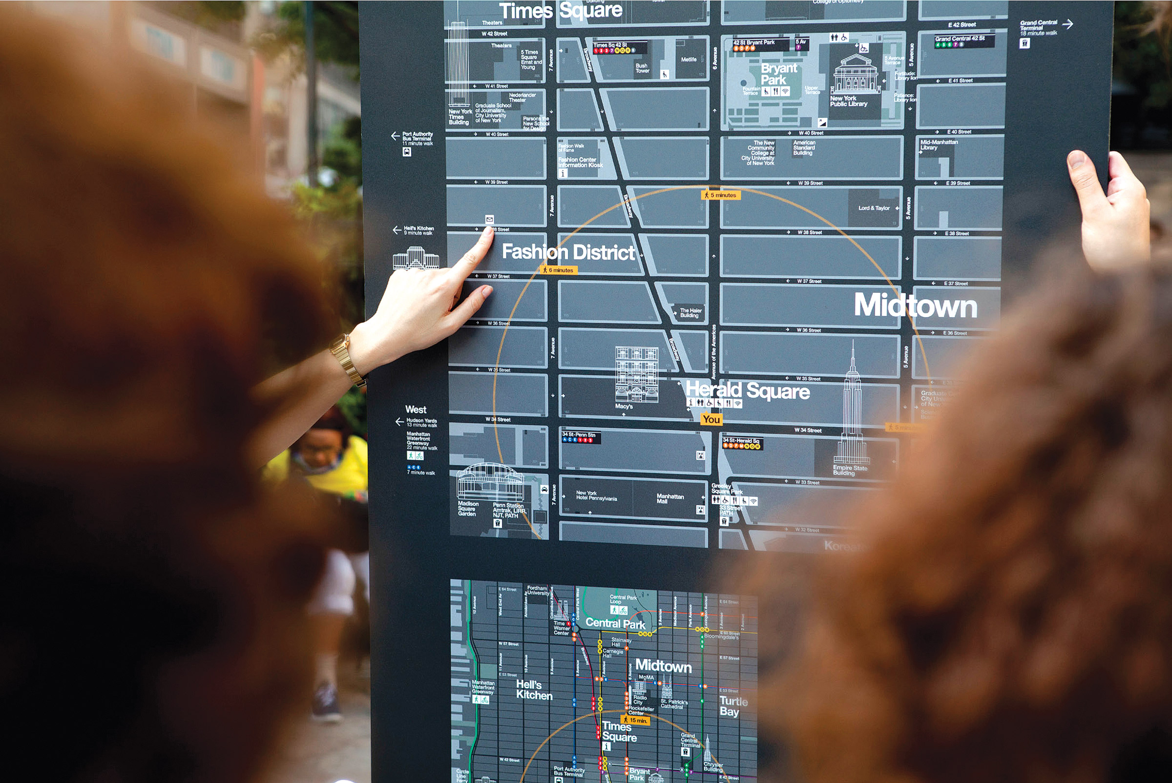
Take New York City, for example. One of our recent projects was a multi-year, comprehensive wayfinding system for New York, involving multiple agencies and partners and mapping the city’s sidewalk for the first time in history. Because we had both tourists and local New Yorkers in mind, a rigorous testing period ensured that the information was clear for everyone of all abilities and location of origin. Overall, the research and design took years to complete, and the project has won numerous awards since its recent rollout.
More recently, we’ve been working on a project here in New York to put mile markers for runners in select parks around the city. This may sound simple on the surface but has huge implications for your everyday park user. Runners may be the primary target, but what about dog walkers? Or a parent pushing a stroller? How about those who can’t run but instead ride a recumbent bike or just walk? And then there’s those who have never run. What will they think when they see these signs? The hope is that new runners/ joggers/walkers may be encouraged by the signs that tell them how far they’ve gone and take the opportunity to become more active. In addition, if wayfinding is present at park entrances, people may learn something new, like the existence of running routes in the park or even the location of the nearest restroom.
However, before designing anything, we have to research how people use the spaces. The design of the park might look great from above, but the actual user behavior may differ greatly. Through observation, we can come up with all sorts of conclusions on user needs and product placement logic. For instance, it was observed that some people in one park like to run adjacent to the paved path on the grass instead, so much so that a “cow path” was present where the grass was worn down. This desire line is telling—if people are running here rather than there, why is that? And how can we accommodate that? Furthermore, if this hadn’t been observed, it’s possible a product could have been placed in the middle of this makeshift pathway, making it more difficult for runners to follow their preferred route. How people-friendly is that?
Happy Habitats, Happy Humans
Think back on your imaginary journey to a foreign city. Imagine this time that wayfinding is included in every stage of the trip. You plan your trip, searching for things to do in the city and mapping where you’ll be staying. You check out how you can get around to your destinations, whether you’ll need to drive, or where the buses can take you downtown. When you arrive, you take the train from the airport and make your way to the hotel. You open your mapping app and find your way to a restaurant within walking distance for dinner. Your friend meets you at a local park where you take a walk around the pond and check out the nearby amenities on a map. You discover bike rentals are on the other side of the park and end your day pedaling with ease, knowing exactly how you’ll be getting back to the hotel.
Cities change and continue to become the dominant habitat for the human species. Although wayfinding may sound like an insignificant part of urbanization, it is an important part of the whole. In many places like highways and airports, wayfinding is considered a necessity. When done right, it is much more than just signs. It is about connecting and informing the many urban inhabitants on their daily adventures moving through these, our urban environments. The right information at the right time can have a huge impact on a person’s experience of a city. As Winston Churchill famously said, “We shape our buildings; thereafter they shape us.” We know the impact of the built environment on people is strong, and being able to democratically navigate our streets—no matter our access or privilege—makes a city a more equitable, walkable, and friendly place for everyone. ●
—
Katrina Johnston-Zimmerman is an urban anthropologist with City ID in New York City specializing in research and analysis of behavior in public space. thinkurban.org
Howie Chen has been exploring photography since high school. While his work primarily focuses on landscapes and nature, he has recently developed an interest in portraiture and social imagery. flickr.com/howielchen8
PentaCityGroup Photos: WalkNYC is a program of pedestrian maps that makes it easier to navigate city streets. Pentagram Design helped create the graphic language of the maps, working on the project as part of PentaCityGroup, a special consortium of designers that also includes wayfinding specialists CityID.